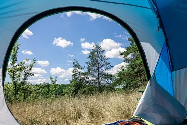
Lines on Paper, Peaks in Sight

Step into the high Alps with confidence as we dive into Analog Navigation in the Alps: Mastering Maps, Compass, and Route Sketching. Expect field-proven practices, vivid stories, and practical checklists that help you move from anxious guesswork to calm, deliberate decisions, even when clouds swallow the trail, batteries fade, or cairns disappear into fresh snow. Share questions, subscribe for future drills, and bring a pencil.

Decoding Alpine Maps

Alpine maps are not flat pictures; they are compressed mountains whispering elevation, exposure, and energy cost. Learn to select the right scale, read contour narratives, anticipate cliffs hidden by shadows, and trace safe corridors past glaciers, scree cones, and summer snowfields. With thoughtful annotations, simple timing marks, and unambiguous arrows, your map becomes a conversation partner that keeps you oriented when valleys echo and peaks repeat, transforming uncertainty into steady, eyes-up movement between reliable catching features.

Choosing the right scale

Pick a scale that matches terrain complexity and visibility. At 1:25,000 you will see tight contour detail, rock bands, and small gullies ideal for steep passes; 1:50,000 simplifies big valley crossings. Favor durable Alpenverein, SwissTopo, or IGN sheets, protect them in a transparent case, pre-fold smartly, and highlight huts, water, bridges, and bailout lines before the first step.

Contours that speak

Contours tell slope, aspect, and strain. Close lines warn of cliffs or avalanche-prone angles; wide spacing hints at rest-friendly benches. Index contours and saddle shapes expose the easiest passage through ridgelines. Use pencil arrows to mark safe ascent and descent lines, noting prevailing aspect and sun exposure that will shape snow firmness, afternoon thunderstorms, and the day’s energy budget.

Symbols that matter

Learn the icon language before boots hit talus. Glaciers, crevasse zones, via ferrata routes, scree fields, seasonal bridges, huts, cable cars, and protected areas each carry distinct marks. Misreading a moraine boundary or summer path classification can waste hours or invite risk. Build a quick-reference corner on your map’s margin, translating critical symbols into plain, personal prompts you will not overlook.

Confident Bearings in Complex Terrain

Magnets and mountains negotiate; you must adjudicate. Understand how a small but meaningful magnetic declination influences your bearing, then reinforce straight-line intentions with natural handrails and disciplined pacing. Learn to settle the needle, sight with patience between gusts, and check drift against terrain clues. A slim compass, clear baseplate, and repeatable routine convert abstract degrees into footsteps aligned with ridges, cols, and safe, testable catching features.

Sketching Routes That Keep You Honest

A quick, resilient sketch captures the route’s bones—baseline bearings, decision points, time windows, ascent totals, and safe exits—so you are never arguing with wishful thinking mid-climb. It lives on your map margin or notebook and updates as reality unfolds. With simple symbols and bold cutoffs, you convert planning into action you can test minute by minute, even when visibility collapses or ambition outruns daylight.

Reading Sky and Snow Without a Screen

The Alps teach with light and wind as much as rock. Learn sky signs that suggest unstable afternoons, how aspect sculpts snow firmness, and when katabatic winds funnel surprises into passes. Blend these cues with map and compass to shift start times, choose safer lines, and respect cutoffs. A practiced eye reduces drama, conserves group energy, and keeps plans aligned with changing mountains.

When Plans Shift: Staying Found and Safe

Detours are inevitable; getting lost is optional. Build routes that fail gracefully by anchoring progress to baselines, backstops, and bailouts you can identify without electronics. Practice quick resets that combine a short halt, a measured bearing, a time box, and a firm decision to reverse or sidestep if confirmation does not arrive. Confidence rises when options are drawn before stress appears.
Name the linear features that guard your flank—ridges, streams, roads, glacier margins—and let them corral error. Draw bold backstop lines behind critical targets and label bailout spurs with times, elevations, and destinations. When fog thickens or thunderstorms sprint over a col, these preplanned rails transform indecision into action, preserving energy, temper, and daylight that you will need for the final safe descent.
Reduce chaos with a set sequence: stop, shelter from wind, confirm map orientation, take a bearing to a reliable handrail, and assign pacing or timing duties. Use box or sweep searches only within tight time limits. Maintain communication and spacing. If verification fails twice, execute the nearest conservative bailout. This predictable choreography shrinks panic, shares tasks fairly, and restores steady feet to wandering minds.
Carry a waterproof map, a dependable baseplate compass, a soft pencil, a thin marker, a small protractor, a whistle, a headlamp with spare batteries, and a heat-reflective bivy. Stash an index card for critical bearings and emergency contacts. None weighs much; together they buy clarity when weather turns unruly, partners tire, or the intended line proves bolder than comfortable prudence.

Setting the line before dawn

We studied slope aspects, highlighted a conservative corridor, and wrote three decision gates with times we promised to respect. Bearings were penciled directly beside index contours to remove ambiguity. Breakfast was early, boots were dry, and spirits were high, because the map carried plain, human notes that transformed big landscape uncertainty into small, verifiable steps any partner could check without argument.

Inside the cloud, calm decisions

When the ridge vanished, we stopped, sheltered behind a boulder, and checked the bearing against a handrail stream we intended to intercept. Pacing and minutes agreed, so we turned as planned, following water noise toward the attack point. A faint cairn appeared exactly where the sketch promised. Even as drizzle chilled hands, the routine kept voices measured and movement steady.

Warm soup, sharper skills

Later, steam fogged the hut windows while we redrew the line with truth instead of optimism. We noted where impatience began to whisper and how the stream’s backstop saved minutes. Those marks now live on the map, ready to guide another party, and to remind us that humble, analog craft often feels slow, yet it quietly delivers friends and stories back to the table.

Practice That Sticks

Backyard drills with big-mountain payoff

Lay out a short loop in a park, sketch a corridor, and walk it on a strict bearing while ignoring paths. Time between landmarks, log micro-errors, then repeat in reverse. Add a night lap with the same sketch. You will feel how tiny attention shifts compound, and how a pencil line, measured minutes, and a steady needle quietly convert wobble into precision.

Night navigation sharpens attention

In darkness, details fade and discipline grows. Practice holding bearings through trees, count steps on uneven ground, and compare estimated to actual times at quiet intersections. Use reflective tacks sparingly to grade your line after finishing. This contained challenge builds confidence for alpine fog, blowing snow, or moonless descents, where calm routines and prewritten notes keep groups moving safely without arguments.

Join the conversation and keep learning

Tell us what paper maps you trust most, which compass model has served faithfully, and how you sketch routes under pressure. Post questions about bearings, declination, or tricky passes, and we will build future drills around them. Subscribe for printable checklists, comment with your stories, and help turn thoughtful analog craft into a shared library that keeps more people confidently exploring.
Noviveltosanopirakentopalo
Privacy Overview

This website uses cookies so that we can provide you with the best user experience possible. Cookie information is stored in your browser and performs functions such as recognising you when you return to our website and helping our team to understand which sections of the website you find most interesting and useful.